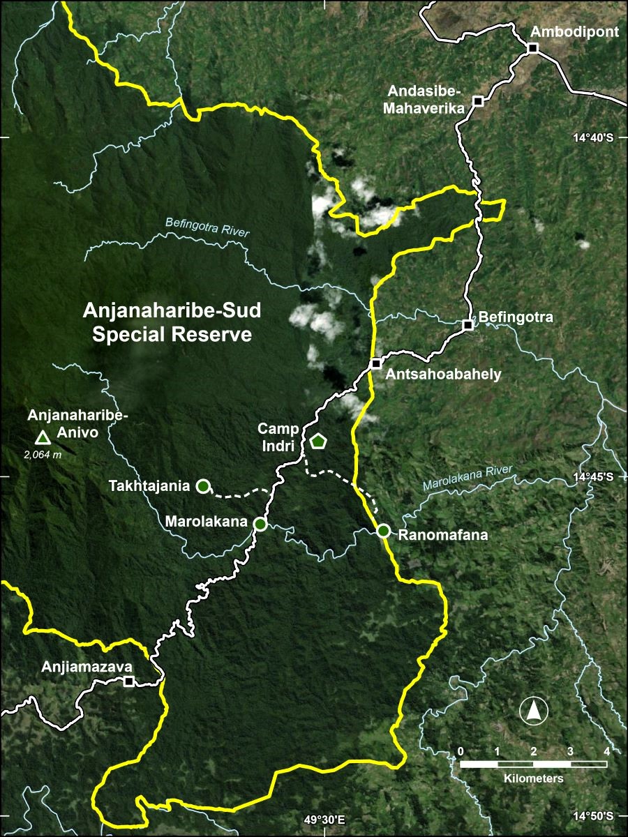
Visiting Anjanaharibe-Sud
Anjanaharibe-Sud offers an outstanding wilderness and cultural experience for those in search of rugged adventure. The reserve is open year-round, but the best time to visit is from October to mid-December when it is less rainy and muddy (although it can rain and be muddy at any time of the year).
Getting to the Reserve
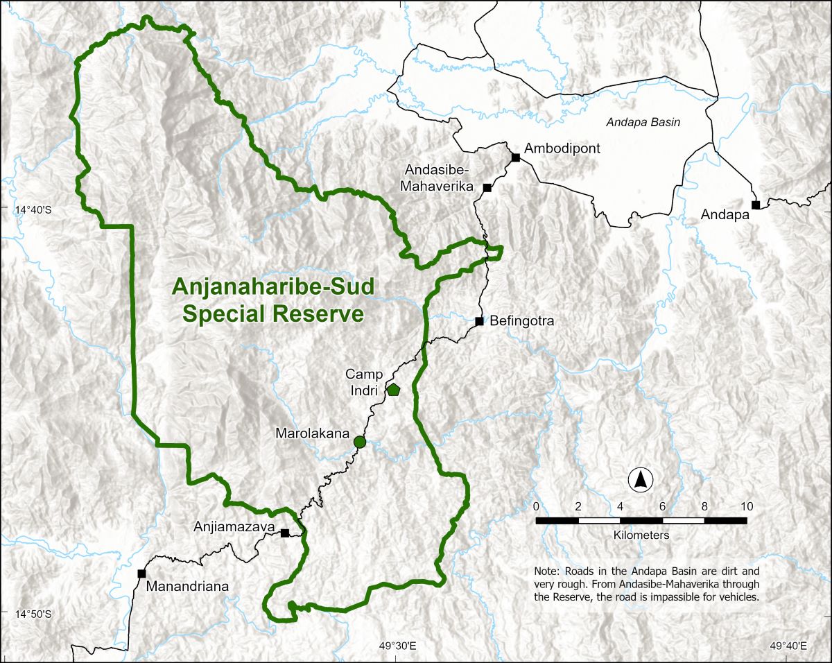
The very primitive road into the reserve starts in the village of Andasibe-Mahaverika, 20 km from Andapa by rutted dirt road. From Andasibe, a 2–3 hour walk leads through forest and fields to the village of Befingotra; after walking another three hours or so one reaches Camp Indri.
Accommodations
In Andapa, a variety of accommodation ranging from basic to comfortable is available (see contact information on the Contacts page). Just outside the reserve in the villages of Befingotra and Anjiamazava, several small “hotely” offer basic Malagasy food and beds in simple, traditional, shared rooms.
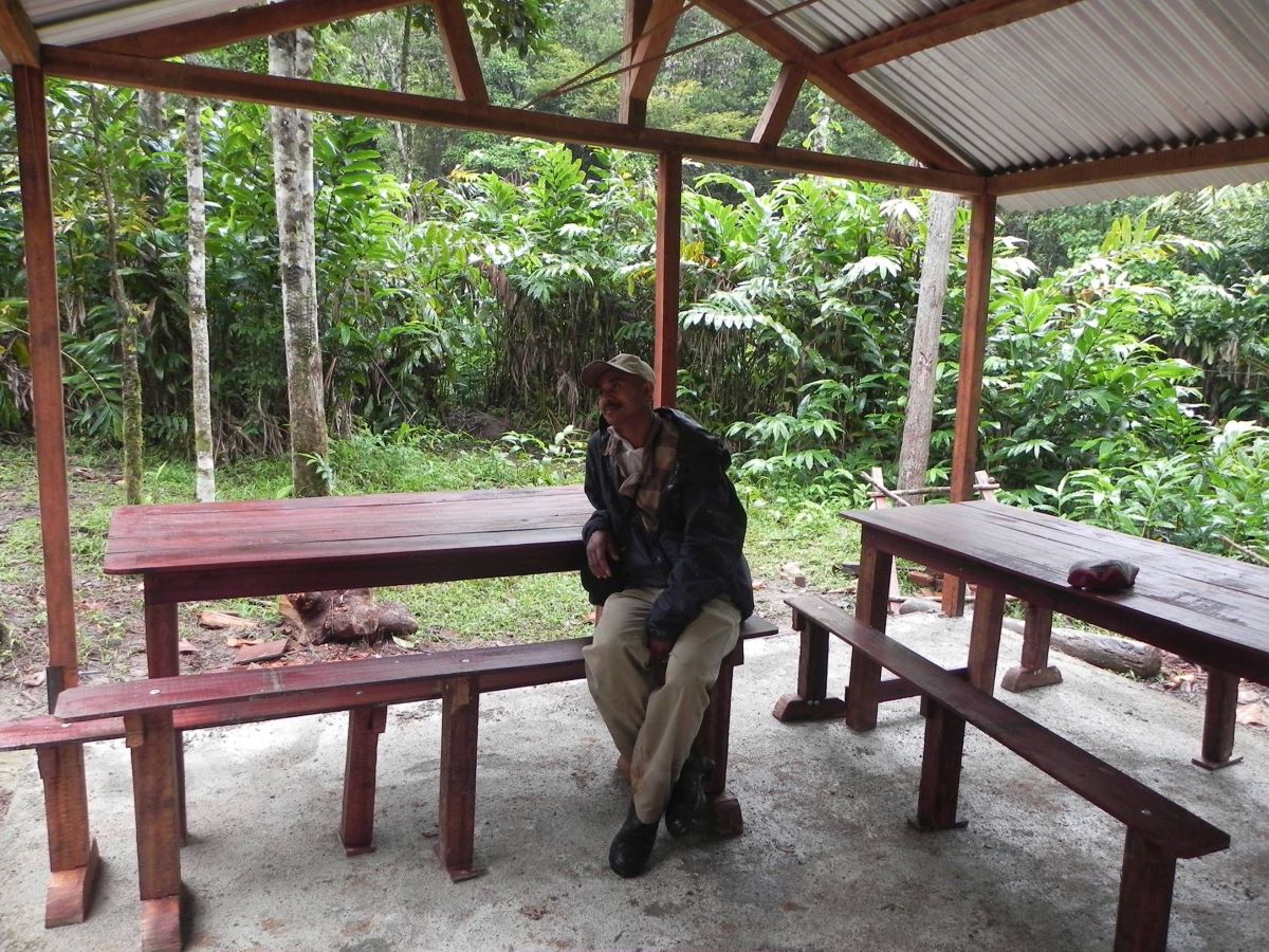
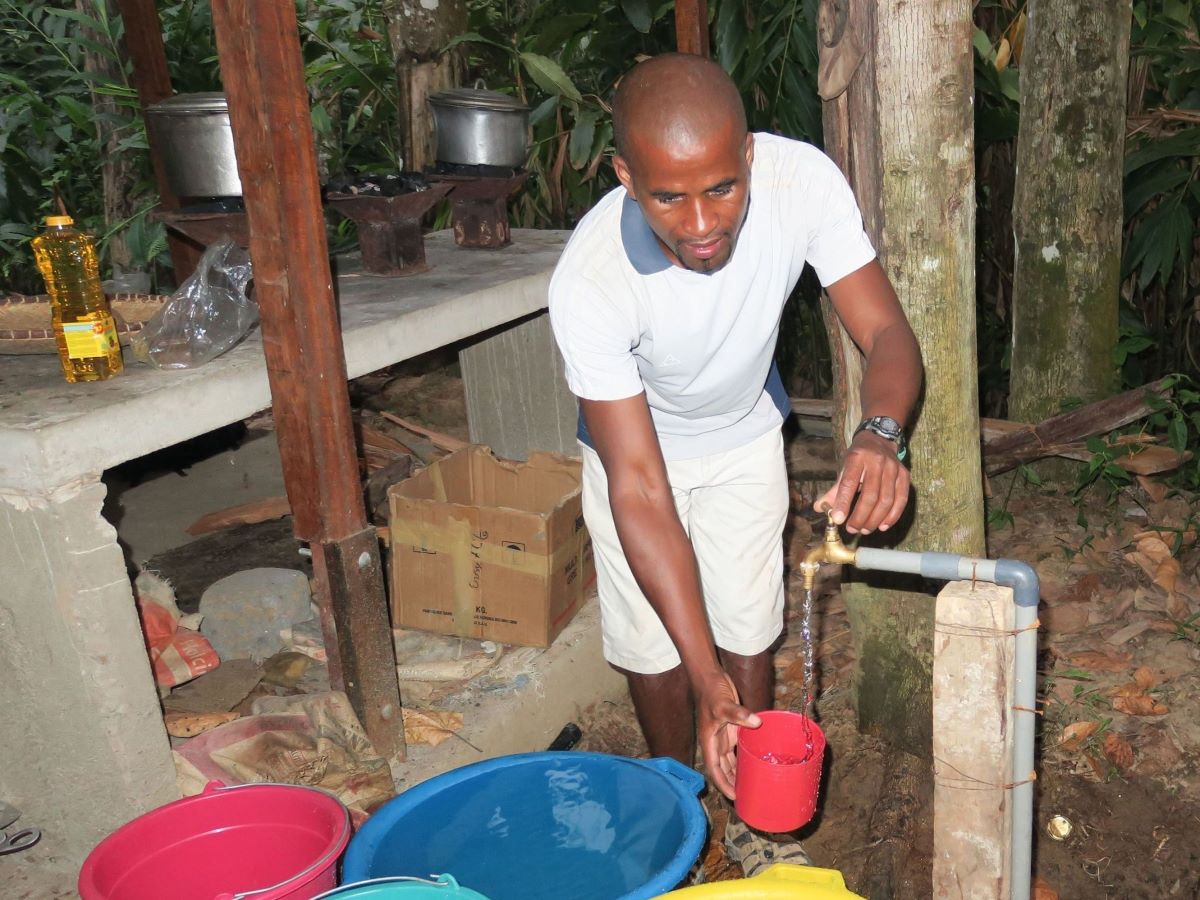
Within the reserve, a fully equipped campsite, Camp Indri, has recently been established deep in the forest at a beautiful site just above the Andranomena River; it’s well worth a stay. Several groups of Indris live in the area around Camp Indri and are often heard calling to one another; a group of Silky Sifakas are occasionally seen near the camp as well. The camp includes a covered dining area, four covered tent shelters, an ablution block and running tap water. Tents and sleeping pads are available, but visitors must supply their own sleeping bags.
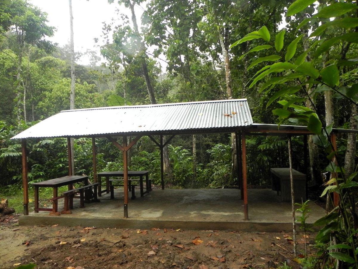
Camp Indri dining shelter (photo courtesy of LCF)
Camp Indri dining area (photo courtesy of LCF)
Camp Indri Cooking Area (photo courtesy of LCF)
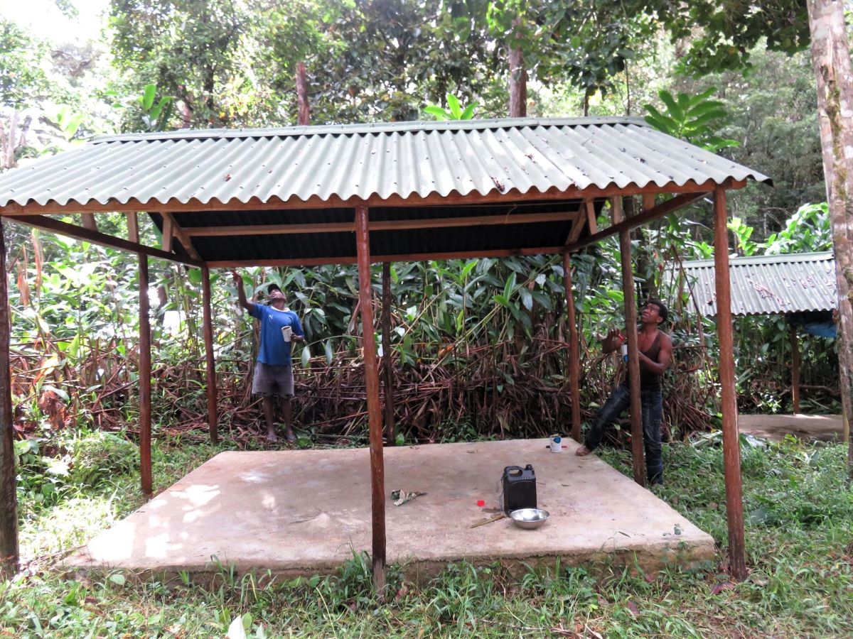
Camp Indri Sleeping Shelter (photo courtesy of LCF)
The Marolakana River crossing also makes for a beautiful camping site, but no amenities are provided here so you will need to be completely self-sufficient with your own tents and cooking equipment.

Marolakana camping area
Marolakana camping area
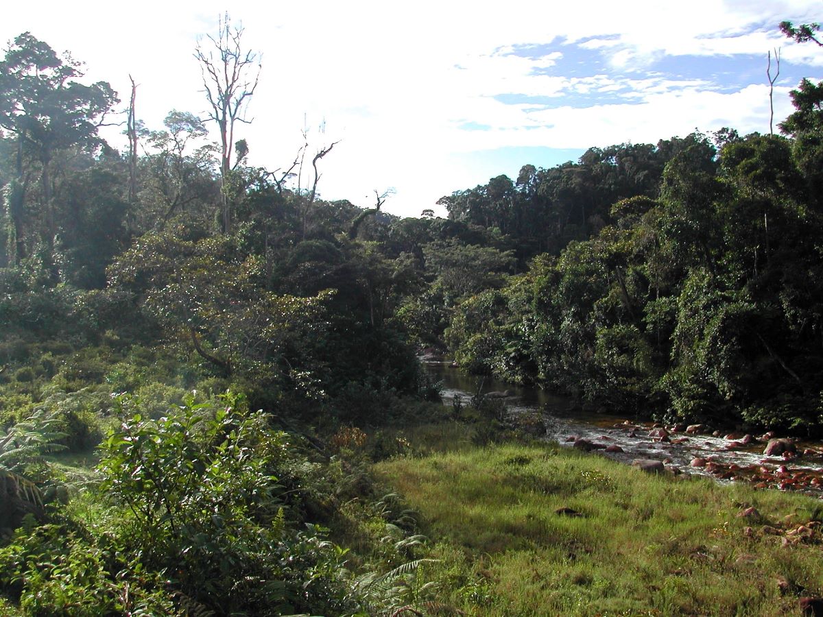
Marolakana River
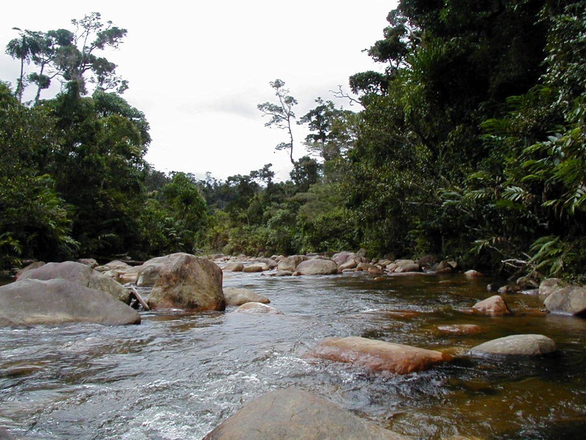
Marolakana River Crossing
Hiking in Anjanaharibe-Sud
Hiking in the reserve ranges from relatively easy to very strenuous and includes several trails. Note that trails may not always be passable due to cyclone or other damage; your guide will have updated information.
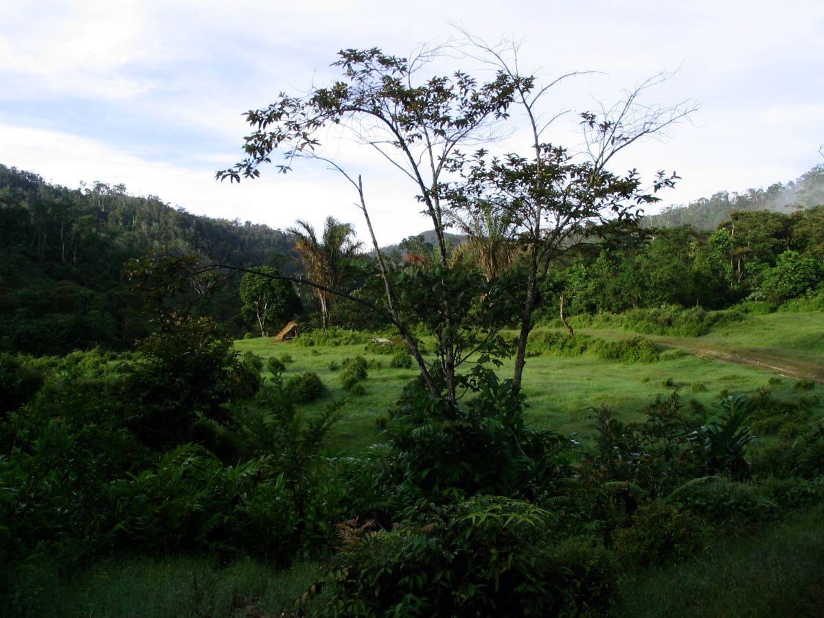
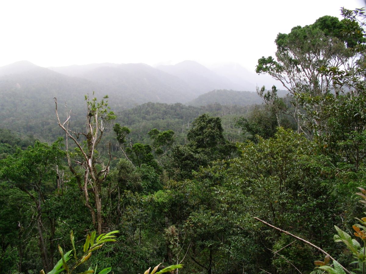
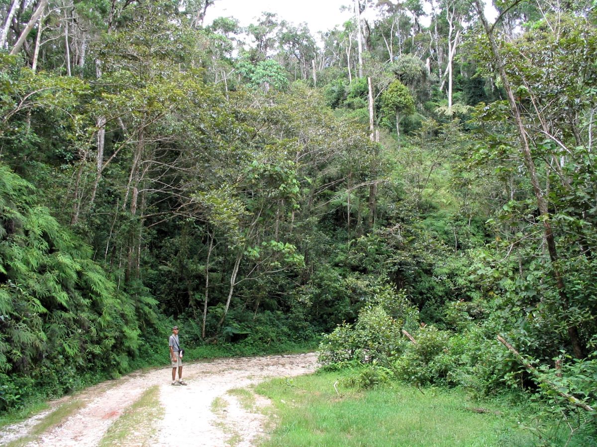
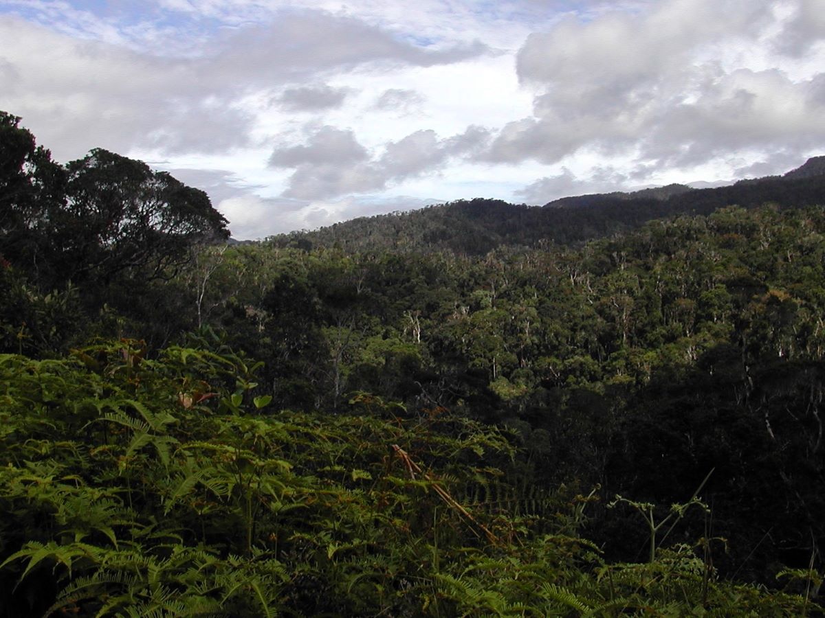
A very rough, narrow dirt road provides a pleasant hiking route through the reserve. This road (originally intended as a national highway but no longer passable to most vehicles) provides beautiful open vistas out over the rainforest-covered mountains. Many birds and lemurs can be seen from along the road, and the eerily beautiful calls of the Indris are sometimes heard. The road is wider and more open than the other trails, and consequently it has fewer leeches. Local people use this route as a footpath between villages on the east and west sides of the reserve — colorful women carrying large bags of rice or peanuts on their heads, men herding zebu or pigs to market, children going to school (sometimes several days’ walk from their homes) ….
The Babakoto Trail is a short loop from Camp Indri that winds through the dense forest. As its name suggests (Babakoto means Indri in the local Tsimihety dialect), Indris are commonly seen and heard along this trail. The trail provides a good opportunity for birdwatching, as well.
The Ranomafana Trail leads 4.3 km from the road near Mandritsarahely Creek to several small hot springs. The springs are a sacred site used to worship the ancestors and as such cannot be used for soaking or bathing. The trail meanders through dense rainforest, then passes a short distance outside the reserve through the tiny village of Andranomafana before crossing the Marolakana River to the hot springs. White-fronted Brown Lemurs (Komba) are commonly seen along this trail, with the possibility of spotting Indris and Silky Sifakas as well. Although not long, this is a fairly strenuous trail due to its primitive state, a difficult river traverse, and the abundance of leeches. [2026 update: Trail may be impassible due to cyclone damage; your guide will have current information.]
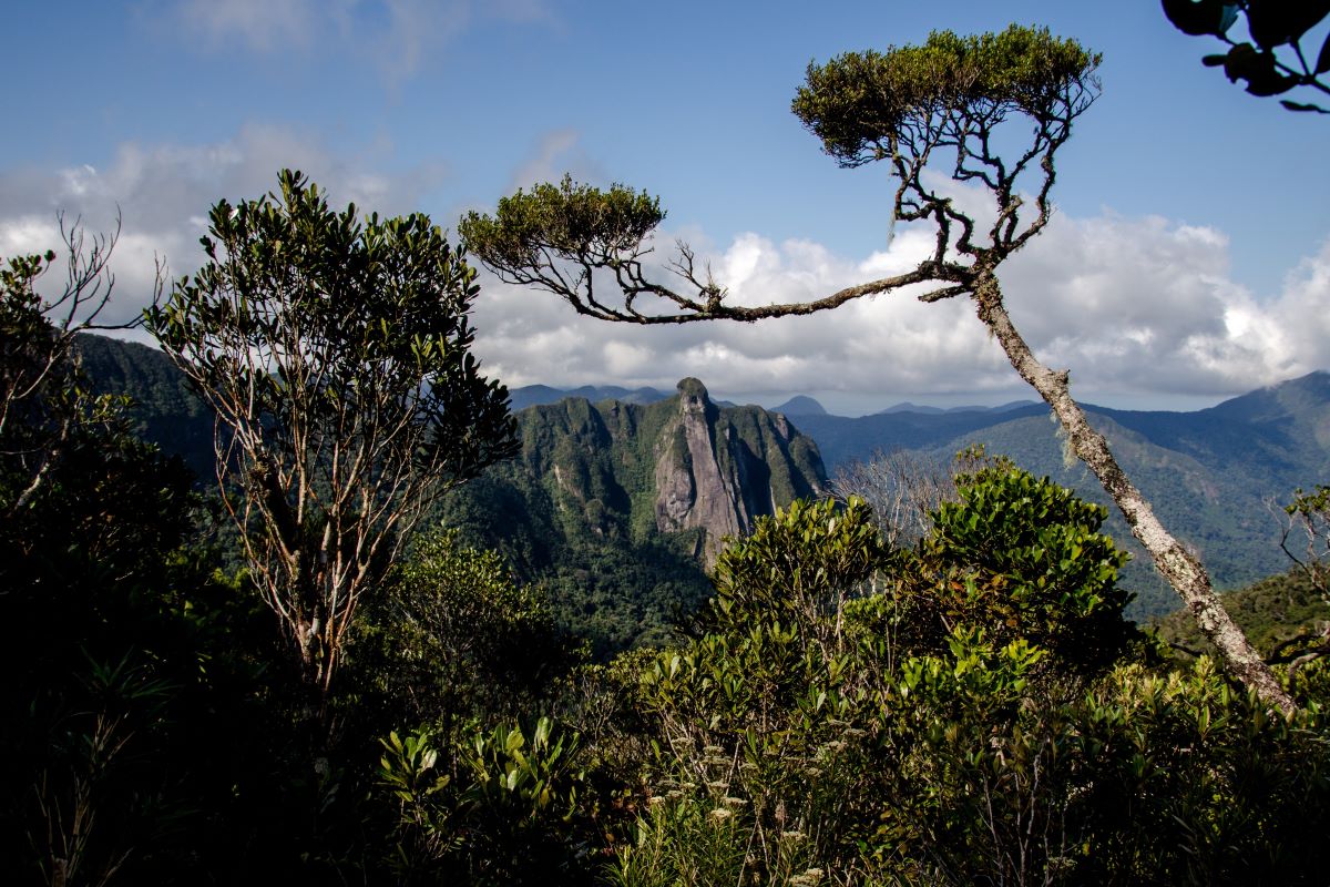
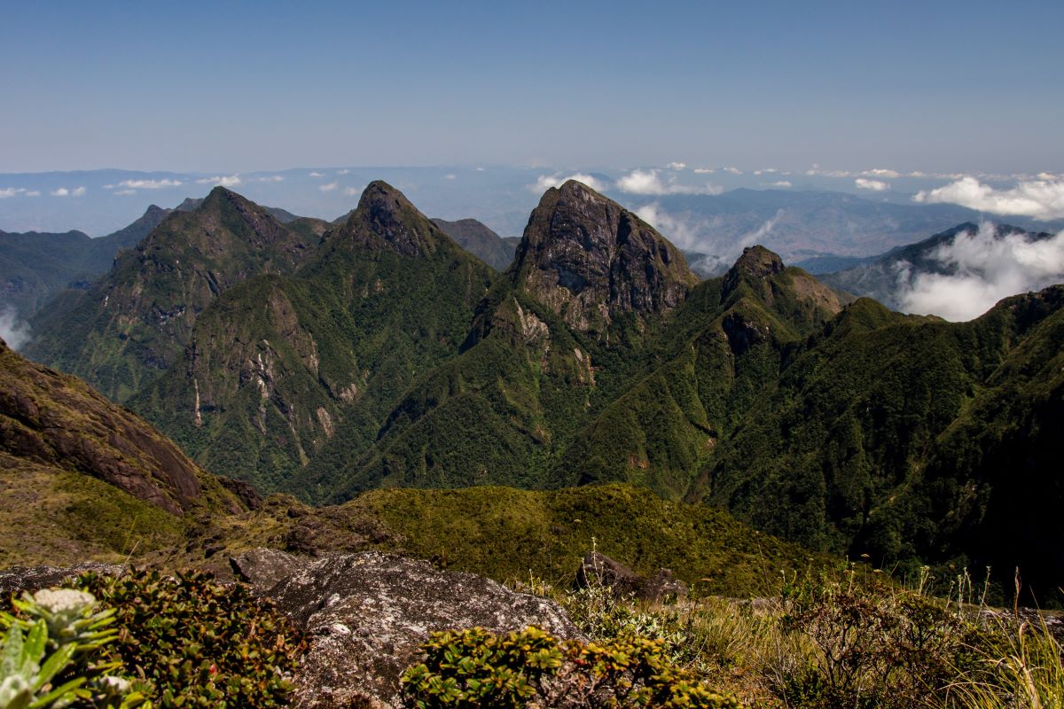
The Takhtajania Trail climbs a ridgeline from the road to a site where the very ancient and rare species of tree called the Takhtajania grows. In addition to the Takhtajania, it is also possible to see Indris and Silky Sifakas, as well as Red-bellied Lemurs. This moderately difficult trail passes through open forest, often abloom with flowers, and affords many beautiful vistas overlooking the seemingly endless waves of rainforest-covered mountains.
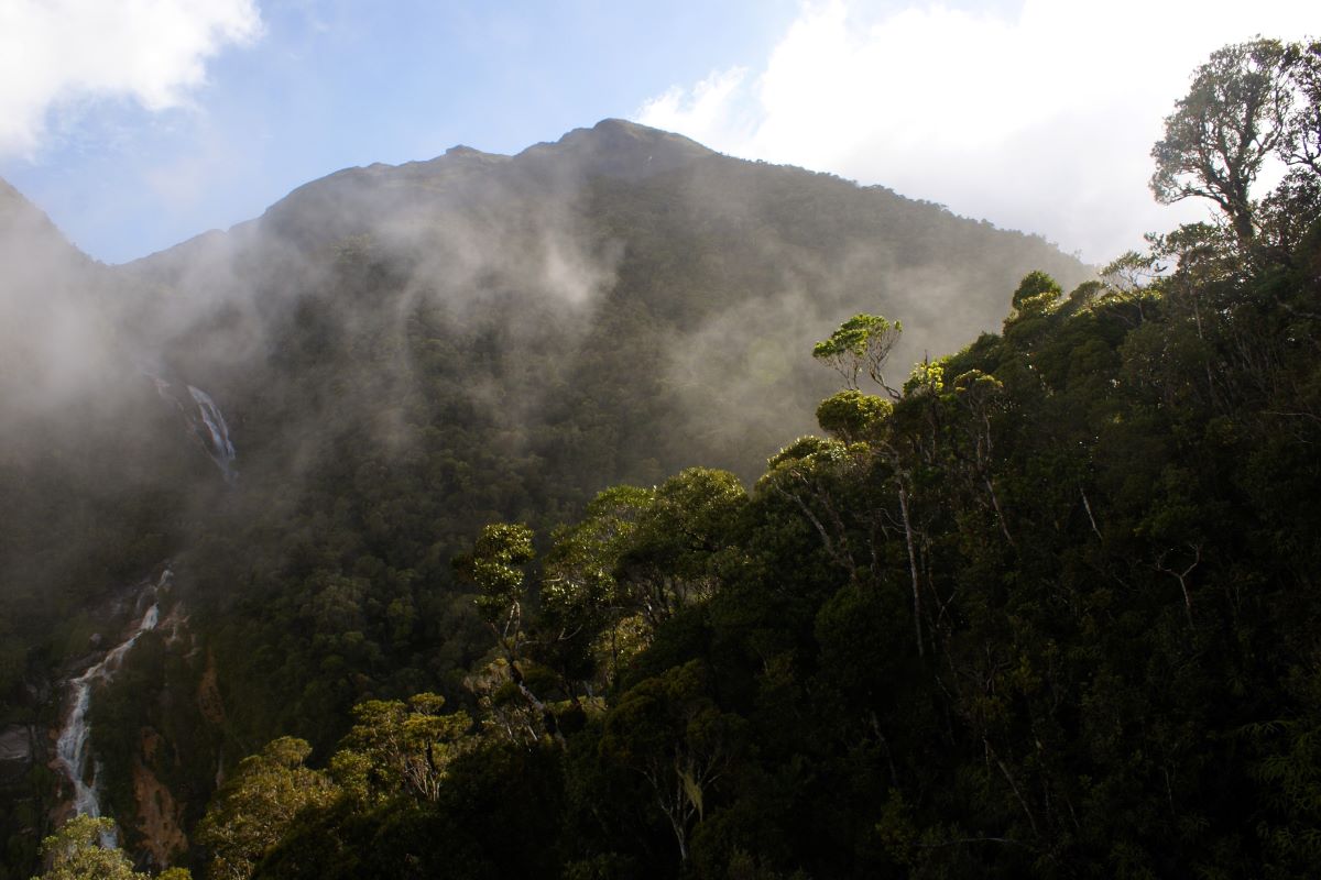
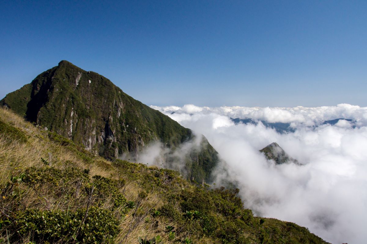
The Summit Trail continues from the Takhtajania site to the peak of Anjanaharibe-Anivo — at 2,064 m (6,772 feet), the highest point in the reserve. This multi-day, very strenuous hike climbs through the mid-elevation rainforest to the high cloud forests, where perpetual mists keep the trees draped in lichens and mosses. [2026 update: Trail may be impassible due to cyclone damage and require special permission to traverse; check with officials at the Manantenina Visitor Center or the Andapa Headquarters building before you go.]
View from the road in Anjanaharibe-Sud
Along the road in Anjanaharibe-Sud
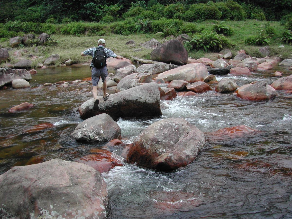
Marolakana River crossing
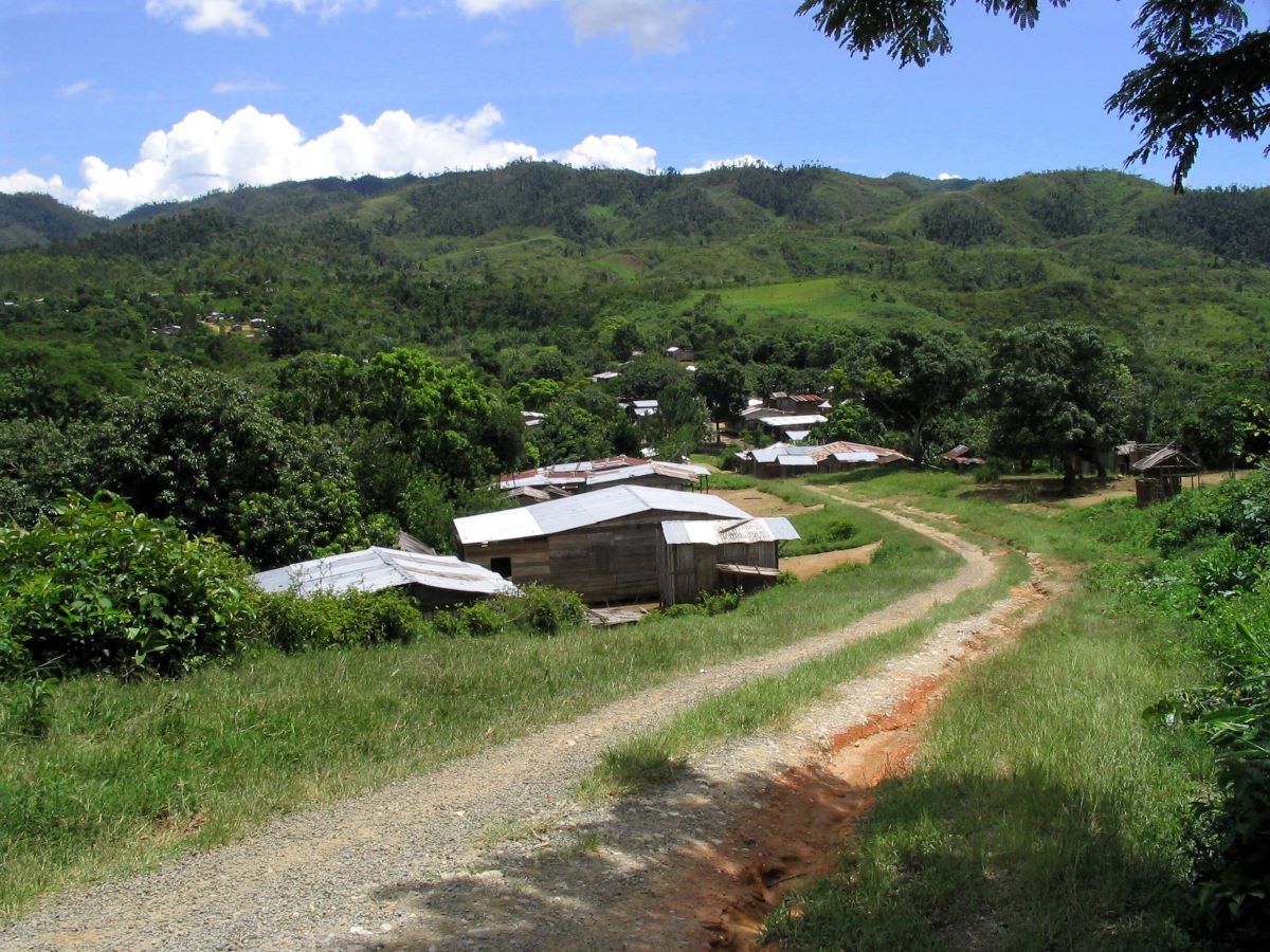
Village of Befingotra
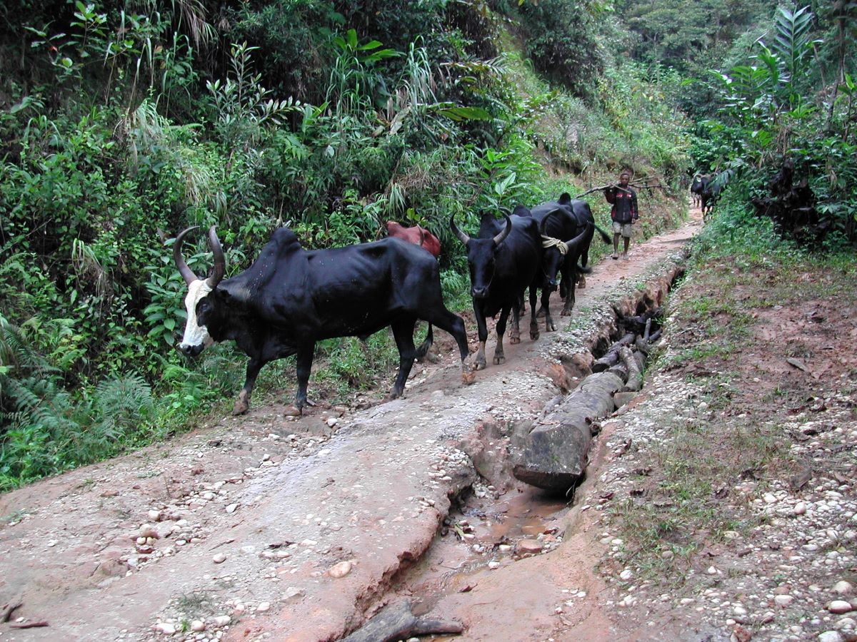
Men driving omby cattle along the dirt track through Anjanahbaribe-Sud
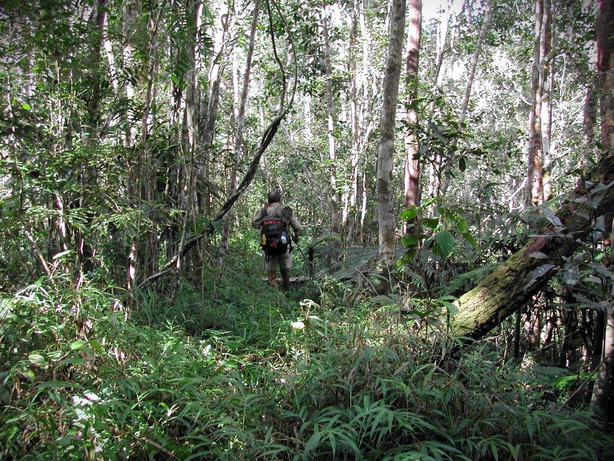
Along the Takhtajania Trail
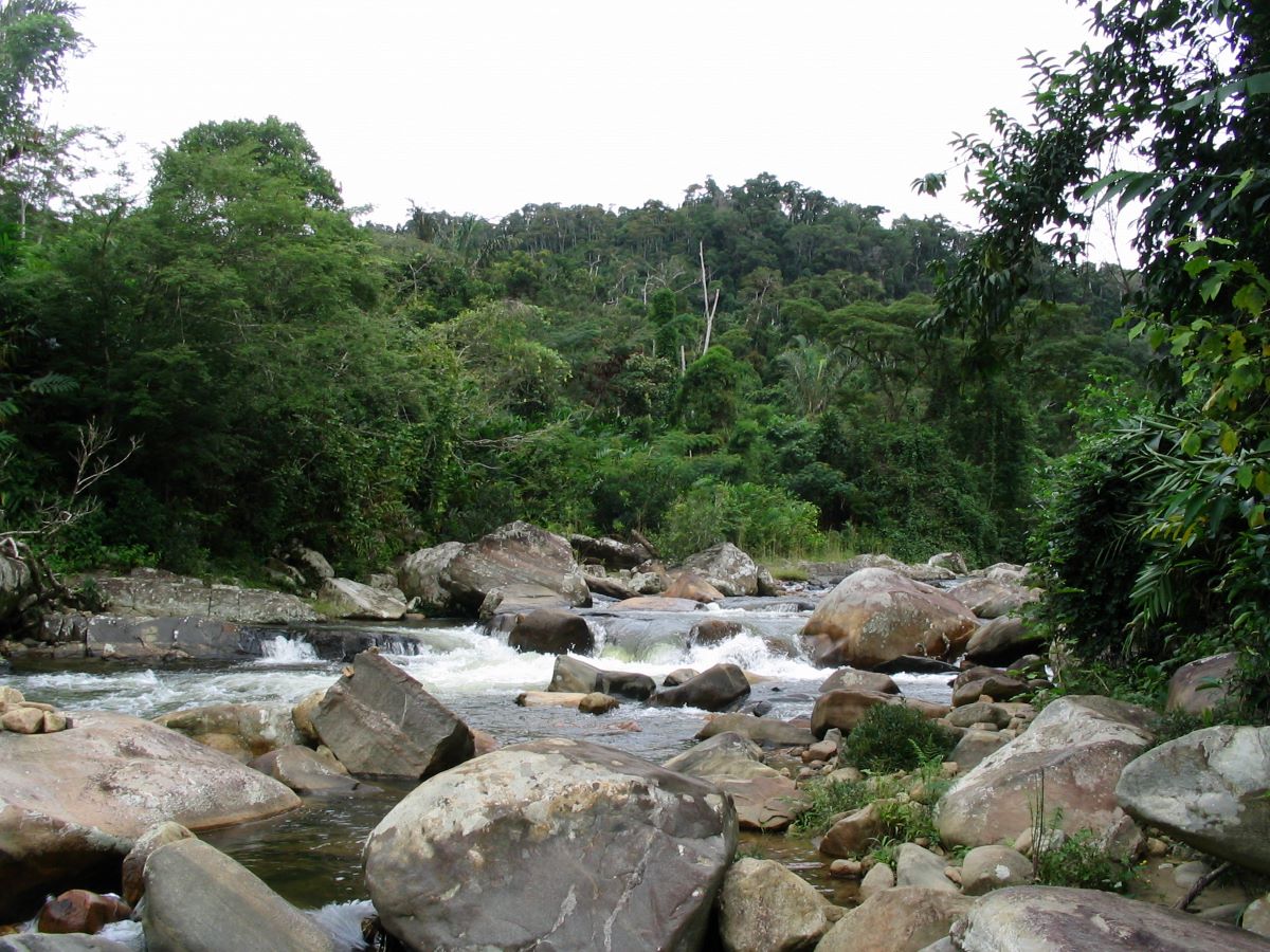
Marolakana River near Ranomafana
View from the road in Anjanaharibe-Sud
Logistics and Fees
It’s easiest to organize your visit through a private tour operator, although experienced visitors are free to organize their own trips. Private tour operators may be able arrange motorcycle taxis which can reduce the amount of walking. Guide and entry fees must be paid at the Marojejy visitor center in Manantenina before entering the reserve. An official guide is required and can be obtained in either Andapa or the village of Befingotra; porters can be hired in the villages of Andasibe-Mahaverika and Befingotra. It’s also possible to take a guide from Marojejy (Manantenina visitor center) but you still must take a local guide from Befingotra. Remember that by employing local people as guides, porters, cooks and trackers, you are providing them with much-needed work, and they and their families are appreciative.
See the current fee list for Anjanaharibe-Sud and Marojejy here.
What to Bring
This is the rainforest, so be prepared for rain, no matter what the season. Bring good raingear, and pack everything in waterproof bags. Sturdy sandals are fine if walking only on the main road through the reserve, but good boots are essential when hiking on trails through the forests. Lightweight clothes are best for daytime travel, but evenings can be cool and an extra, warmer layer may be needed. Mosquito repellent will keep the mosquitoes at bay, and long pants tucked in socks will help to repel leeches. There are no dangerous animals (other than rare scorpions) in Anjanaharibe-Sud.
Food for your stay should be purchased ahead of time in Andapa, where there are many shops. Food may be available for purchase in Andasibe-Mahaverika, Befingotra and Antsahoabahely, but supply and variety are never guaranteed in these small villages. Good water is piped into Camp Indri and is abundant in streams throughout the reserve so there is no need to bring in bottled water; however, filtration and/or purification tablets are always recommended.
See a suggested packing and food list for Anjanaharibe-Sud and Marojejy here.
Details for a typical journey from Andapa to the Reserve, with a stay at Camp Indri
It can take an entire day to get from Andapa to Camp Indri so it’s best to leave Andapa early in the morning. From Andapa it’s about 20 km on a bumpy road to Andasibe-Mahaverika via Ambodipont (see map at top). Public taxi-brousses only go as far as Ambodipont, so you will either need to rent a car or else walk the 3 km from Ambodipont to Andasibe-Mahaverika. Porters can be hired in Andasibe-Mahaverika if you need them. From Andasibe-Mahaverika, it’s about a two-hour walk to Befingotra where porters are changed, and then another three-hour walk to Camp Indri. Befingotra is a small village with several tiny restaurants where you can get a good plate of rice for lunch. It also has a few basic “hotely” if you want to spend the night. Just at the reserve entrance is a small outpost called Antsahoabahely where you can usually buy snacks from roadside vendors. Note that the road inside the reserve is severely rutted and washed out in many sections so is no longer passable for cars. It’s possible to reduce the amount of walking by organizing motorcycle taxis – but of course by so doing you choose mechanics over people and you will not see as much wildlife.
We recommend spending at least three nights at Camp Indri to see the Indris and Silky Sifakas and possibly do some other hikes in the reserve. The trip back to Andapa from Camp Indri is just the reverse of the trip in and takes a full day.
Around the Area: Antanetiambo, Agnatialahely, and Marojejy
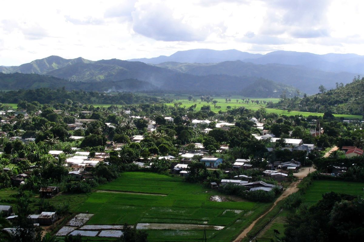
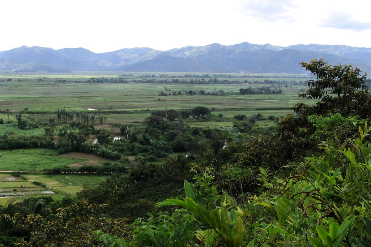
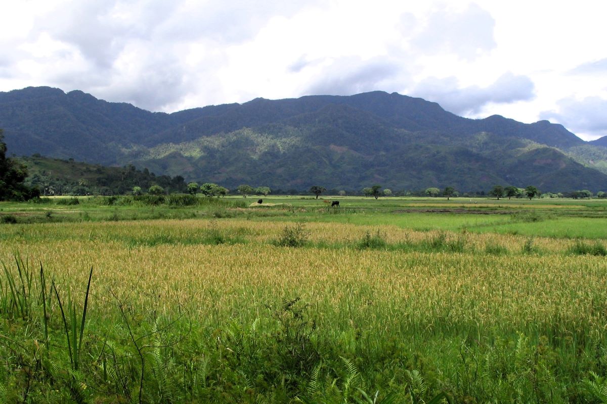
Often called the “rice basket” of northeastern Madagascar, the vast, flat Andapa Basin is an emerald-green expanse of rice fields. It is surrounded on all sides by the high mountains of Marojejy, Betaolana, and Anjanaharibe-Sud, and is dotted throughout by small, picturesque villages. The town of Andapa makes a good base for exploring the basin by foot or by bicycle. Two small private reserves are worth visiting in the Andapa Basin: Antanetiambo, owned and managed by local environmentalist Mr. Rabary Desiré, offers an excellent introduction to the unique natural and cultural histories of the area; and Agnatialahely provides a great opportunity to spend time in a nice area near Andapa, sharing good meals, visiting a nearby waterfall and river, and watching wildlife. The magnificent Marojejy National Park lies just to the northeast of the Andapa Basin and can be accessed from the village of Manantenina, 40 km from Andapa along the road to Sambava.
Town of Andapa
Fish pond in the Andapa Basin
Antanetiambo Nature Reserve and the Andapa Basin
Andapa Basin from Antanetiambo Reserve
View of Ambatotsondrona from trail to Marojejy summit
Waterfalls in the high mountains of Marojejy
Near the summit of Marojejy
The peaks of Marojejy